Trekking

CHILE – PATAGONIA ON THE TRAIL OF THE PIONEERS.
The itinerary

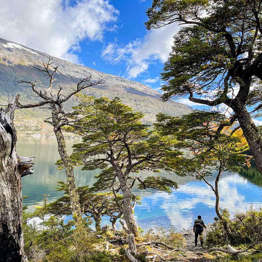
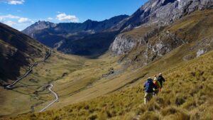
Pristine rivers and lakes, deserted expanses, rugged peaks and mighty glaciers: this journey takes us right into the heart of the Aysén region, one of the least visited and largely unknown regions of Patagonia. We follow the mystical Carretera Austral to its southern end and hike on hidden and almost forgotten paths in the footsteps of the first settlers. Away from the well-known tourist attractions further south, we have the unique opportunity to experience the authentic Patagonian culture up close.

Route

Journey into the wilderness - On the trail of the pioneers

Region

Aysen - Chile

Duration

20 days

Dates

January, October, November, December

Price

Send us an email for detailed information. per person (does not include flight)

PHYsical level

Hard

Technical level

Medium

Altitude

Security

Satelital phone, Each VHF radio guide, First-aid kit

On our hikes we are accompanied by gauchos and their pack horses and in this way we get an insight into a world that has long since disappeared elsewhere. We explore places that are far off the beaten track and only visited by a few people each year. The tours are demanding and always entertaining.

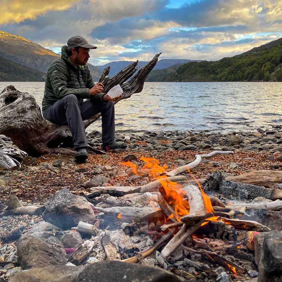
We cross torrential glacier rivers, traverse extensive scree fields and get wet feet in some places. At the evening campfire in the camp, however, these challenges are quickly forgotten. This is wild Patagonia – memories we will never forget.

Expedition Itinerary

Ready for the adventure?

DAY 1: Arrival

Arrival is via the international airport in Santiago de Chile with a direct flight to Balmaceda, near the regional capital of Coyhaique. At the airport the Apacheta staff will be waiting for you and together we continue to the nearby village of Villa Cerro Castillo, where we spend the first night in simple accommodation at the foot of the imposing Cerro Castillo massif.

(B, L, D)
Overnight: Simple guest house
Driving time: 1.5 hours

DAY 2: Villa Cerro Castillo – Valle del Avellano

Just behind the village we take the path that leads us past the remote farms into the backland. A very scenic route on an increasingly adventurous gravel road. We reach the starting point of our hike to the spectacular and still almost completely unknown granite towers Torres del Avellano. Here we load the equipment onto the pack horses and follow a gaucho path through enchanted southern beech forests that is hardly used today. We set up our camp for the next two nights at the edge of the forest at the confluence of two raging mountain streams not far from the tree line.

(B, L, D)
Overnight: Camp Confluencia
Driving time: 2 hours
Walking time: 4-5 hours

DAY 3: Camp Confluencia – Viewpoint Torres del Avellano – Camp Confluencia

Just behind the camp we start climbing steeply through the forest until we reach the tree line and have a clear view of the impressive granite walls of the Torres del Avellano for the first time. The way leads from here through alpine terrain, the scree fields to be crossed require sure-footedness and Persistence. But the effort is rewarded; we reach a turquoise glacial lagoon where the glaciated granite rocks are reflected on windless days. From here we continue a short steep climb and we arrive at our destination. . We reach a mountain saddle from which offers us a spectacular view of the entire Avellano massif. Afterwards, we return to the camp on the same route.

(B, L, D)
Overnight: Camp Confluencia
Walking time: 6-7 hours

DAY 4: Camp Confluencia – Puerto Guadal Camping Alma Verde/ Mallín Grande (Fundo San Jose).

Today we return to the starting point of our hike. Our vehicle will be waiting for us and we continue on one of the most picturesque country roads in the region on the way to the south. We reach the crossroads of the mythical Carretera Austral (Ruta 7) and follow it to the village of Puerto Río Tranquilo on the shores of the majestic Lago General Carrera, South America ‘s second largest lake. Here we take a lunch break and take a trip by boat to the famous marble caves on Lake General Carrera.
The remaining distance always opens up new views over the lake and the highest peaks of the northern Patagonian Ice Field. In the afternoon we reach our accommodation for the next two days and treat ourselves to a well-deserved rest.

(B, L, D)
Overnight: Puerto Guadal (Camping Alma Verde)/ Mallín Grande (Fundo San José)
Driving time: 5 hours
Walking time: 3-4 hours

DAY 5: Day hike to the valley “Valle Sin Salida”

A long day of hiking awaits us today. Early in the morning we make our way to the
Starting point of our hike. We cross an untouched jungle of southern beeches,
a completely unknown valley, the “Valle Sin Salida”, where at the end of the valley a beautiful glacier awaits us. With a bit of luck we might even see Huemules in the wild. This deer species is the Chilean national animal and is threatened with extinction. In this hidden corner of the Patagonia National Parks, we have a better chance of sighting than anywhere else. After a long lunch break, we return to our vehicle the same way and spend another night in our accommodation.

(B, L, D)
Overnight: Puerto Guadal (Camping Alma Verde)/ Mallín Grande (Fundo San José)
Driving time: 1 hour
Walking time: 6-7 hours

DAY 6: Mallín Grande – In the footsteps of the gauchos

We make a short drive towards Mallín Grande. This tiny village is right on the edge
of the Patagonia National Park. The area surrounding the village is characterized by dreamy mountain landscapes and the authentic, still largely traditional Patagonian way of life.
On a nearby farm we meet the gaucho Don Eliberto and his pack horses who will accompany us
for the next three days. Uphill we follow an old forest path that winds its way idyllically along remote farms through the characteristic southern beech forest meanders. Directly above the tree line we reach today’s camp, from which we have a spectacular view towards the snow-capped peaks of the Jeinimeni Mountains. With a little bit of luck we might also meet Don Miguel, a local gaucho who spends the warm summer months here with his herds of sheep and is always happy to have some company. At the nightly campfire we can listen to his always entertaining stories and get a unique insight into the Patagonian gaucho culture.

(B, L, D)
Overnight: Camp Verenada
Driving time: 40 minutes
Walking time: 2-3 hours

DAY 7: Pampa del Zorro

Right at the beginning of the day we continue to climb until we reach a spectacular high plateau, from which, on a clear day, we have a magnificent view over Lago General Carrera and the North Patagonian Ice Cap. We hike above the tree line through a landscape of bizarre contrasts, the unique coloring of the high concentration of mineral rocks. With a watchful eye, we can even discover fossil remains of dinosaurs! At the end of the day we descend into the forest and reach today’s camp in the idyllic Pampa del Zorro, overlooking the hanging Glacier of Mount Tronador.

(B, L, D)
Overnight: Camp Pampa del Zorro
Walking time: 4-5 hours

DAY 8: Descent and drive to Fundo San José

Today we make our way back towards Mallín Grande. A long day of hiking with several river crossings separates us from the “return to civilization”. We are rewarded for our efforts with beautiful panoramas.
Finally, we meet our driver and after a short drive, we get our nightly
Accommodation in a magnificent country house at Fundo San José, right on the shore of the lake. Here we can give our battered feet a well-deserved break.

(B, L, D)
Overnight: San Jose Farm
Driving time: 40 minutes
Walking time: 6-7 hours

DAY 9: Drive to Villa O’Higgins

Today is a classic driving day on the program. Early in the morning we set off
to the south towards Villa O`Higgins, equivalent to the end of the Carretera
Austral.
The last section meanders breathtakingly through evergreen primeval forests, considered one of the most beautiful car routes on the entire continent. Nevertheless, we are all happy to reach our accommodation after many hours on the car. .

(B, L, D)
Overnight: Simple guest house
Driving time: approx. 8 hours

DAY 10: Beginning of trekking “Ruta de los Pioneros”

The morning is for free time. There is a small hike leading to different view points over the village and can be made on your own. After lunch we drive to the starting point of the hike, where we first put our equipment on the load horses. After a short hike we reach our first camp on the banks of the Lago Christie, which invites us to take a refreshing swim on warm days.

(B, L, D)
Overnight: Camp Lago Christie
Driving time: 1 hour
Walking time: 2-3 hours

DAY 11: Trail of the Pioneers

Today we hike from Camp Lago Christie to Camp Puesto Entre Lagos. On the way we pass one
of the few active . Gaucho Don Rubén is always happy to have visitors with whom to share a “mate” . The partly muddy path makes up for its impressive panoramic views over Lake Christie. Today’s camp is beautiful right on the Lakeside and offers enough space for a warming campfire.

(B, L, D)
Overnight: Camp Puesto Entre Lagos
Walking time: 5-6 hours

DAY 12: Trail of the Pioneers

We hike from Camp Puesto Entre Lagos to Camp Casa Margarita Bustos, another
remote farm that is only sporadically inhabited. Today is a constant up-and- down, but what ensures that we never get bored. After all, there is a way behind every incline
downhill again, that much is certain. We set up our camp again directly on the shores of the lake. .

(B, L, D)
Overnight: Camp Casa Margarita Bustos
Walking time: 4-5 hours

DAY 13: Trail of the Pioneers

Hike from Camp Casa Margarita Bustos to Camp Lago Alegre. It stays with the already
usual ups and downs as we wander through pristine forests and around every corner
a breathtaking panorama awaits us. The glacier-capped peaks of the surrounding Mountain ranges ensure constantly changing photo motifs. We reach Lago Alegre and camp once again directly at the lake. Lago Alegre enjoys the reputation of being the best lake for fishing enthusiasts by far‘. This is probably simply because the trout are not used to anglers. Here only a few visitors make it each year.

(B,L,D)
Overnight: Camp Lago Alegre
Walking time: 3-4 hours

DAY 14:Trail of the Pioneers

Today it is a little easier. Right at the beginning there are 200 meters of altitude to overcome, after that it is mainly downhill and the terrain becomes more even. We follow the banks of the Río Bravo, once again we dive deep into the southern beech forests and reach a small clear place where we set up our camp for the night.

(B,L,D)
Overnight: Camp Puesto El Burro
Walking time: 5-6 hours

DAY 15: Trail of the Pioneers

The landscape now becomes increasingly open and dramatic. We cross smaller rivers several times and reach a plateau, that on clear days, we have a view of the mighty glacier. We set up our camp in a small forest on the edge of the tree line and enjoy the view of the increasingly rugged landscape.

(B,L,D)
Overnight: Camp Alaska
Walking time: 5-6 hours

DAY 16: Trail of the Pioneers

The first ascent is directly in the morning. The landscape becomes barren and high alpine, finally we leave the protective forest behind us. Through rugged terrain we climb to a pass, which not only marks the highest point of the hike, but also the border with Argentina.
So we have the pleasure of hiking for a few kilometers in the neighboring country. From now on we climb steadily downhill and finally reach the key point of the hike, the legendary Paso La Picota. Here we face the final test by crossing a river. . The ice-cold glacial river Río Pedregoso has to go through a narrow and raging section to be crossed, which is a challenge on normal days. After heavy rains or very hot summer days, it can happen that the river becomes impassable due to the snowmelt and we spend a night waiting for levels to drop again. Otherwise we continue our way for a short distance and set up camp within sight of the pass.

(B,L,D)
Overnight: Camp Puesto La Picota
Walking time: 5-6 hours

DAY 17: Trail of the Pioneers

On the last day of our hike we descend back into the forest and follow the course of the river.
The signs of approaching civilization are becoming increasingly apparent: abandoned farmhouses, fences, occasionally even cows. An unmistakable sign that the end of the hike is near.
We reach the end of the hike at the Calluqueo Glacier, where our driver is already waiting for us.
From there we drive to the nearby town of Cochrane where we spend the night.

(B,L,D)
Overnight: Simple guest house
Driving time: 1 hour
Walking time: 4-5 hours

DAY 18: Reserve day (extra day in case the Río Pedregoso is impassable at Paso
La Picota)

Extra day in case the Río Pedregoso is impassable at Paso La Picota

DAY 19: Drive from Cochrane to Villa Cerro Castillo

After a late breakfast we make our way back north and spend the night in Villa Cerro Castillo, a place we already know. We have a free afternoon that can be used to visit the local museum or nearby rock paintings.

(B, L, D)
Overnight: Simple guest house
Driving time: 4 hours

DAY 20: Transfer to Balmaceda Airport

Villa Cerro Castillo is about an hour’s drive from Balmaceda Airport. From there, departure is via Santiago de Chile International Airport.

difficulty level

Physical requirement

Technical level

Easy

Medium

X

Hard

X

Expert

expedition season

Jan

X
Feb
Mar

Apr

May
Jun
Jul

Aug

Sep
Oct
X
Nov
X

Dec

X

What IS includeD?

Mountain guide

Experienced, multilingual mountain guide (Spanish, English, German).

Hotel

3 – 4* Hotels.

Security

Safety and emergency equipment: radio equipment, satellite phone, oxygen, emergency medicine, all permits for the expedition.

Transfers

Private vehicles (Toyota Hilux 4×4 or similar) throughout the Expedition.

Food

1 cook throughout the expedition.

not included

Not included

  • National and international flights.
  • Personal travel insurance.
  • Any additional costs incurred for program changes due to exceptional circumstances (eg extreme weather, natural disasters, strikes, etc.).
  • Any additional costs incurred due to the participant’s request.
  • Program changes.
  • Porters.
  • Drinks in hotels/restaurants.
  • Personal excess baggage charges.
  • Any additional costs incurred due to the participant’s request program changes.
  • Individual supplement in hotels/pensions.
  • Individual occupancy in double tents.
  • Tips.
  • Personal Equipment (See recommended equipment).
  • Any other service not included in the program.

other expeditions that may interest you

17 Days

Altitude: 6893 m.a.s.l

Physical level: Hard

Technical level: Easy

16 Days

Altitude: 6090 m.a.s.l

Physical level: Medium

Technical level: Easy

16 Days

Altitude: Over 3000 m.a.s.l

Physical level: Medium

Technical level: Easy

14 Days

Physical level: Medium

Technical level: Easy

"Our travel destination is never a place, but a new way of seeing things."

Henry Miller.