Mountaineering

CHILE – VOLCANO GUALLATIRE
The itinerary

On the road in the land of contrasts in the northern Chile – from the desert to over 6,000m.
This demanding trekking trip also makes mountaineers’ hearts beat faster and takes us from the sea to the highest peaks in the region. On the road in the land of contrasts in the north of Chile – from the desert to over 6,000m.

Route

VOLCANO GUALLATIRE 6090m – (16 Days)

Region

Arica y Parinacota , Chile

Duration

16 days

Dates

March, April, May, June, July, August, September, November, December

Price

Send us an email for detailed information per person (does not include flight)

PHYsical level

Medium

Technical level

Easy

Altitude

6090 m.a.s.l.

Security

Oxygen, Satelital phone, Emergency medicine, All permits for the expedition

We begin our journey on the Pacific Ocean and acclimatize in the midst of the bizarre desert landscapes of the Atacama Desert. The few water-bearing rivers transform some parts of the driest desert on earth into unique oases, which we explore on foot. We climb higher and higher and finally reach the altiplano. The deserted Andes plateau is full of surprises. The section between Iquique and Arica is largely unknown and, apart from a few traditional villages, has only a few visitors.

We climb the active volcano Isluga and reach the lonely Surire salt flats on the Bolivian border. We always have the salt lakes, volcanic peaks and even the numerous natural thermal springs to ourselves – we only have to face the critical looks of the local fauna. The area is one of the most important breeding grounds for flamingos and, depending on the season, these exotic-looking birds can be found here by the thousands. Our constant companions include the vicuña and alpaca herds, who brave the freezing nights of the Altiplano here. From our spectacularly situated tent camps we climb some of the most beautiful peaks in the region and after successful acclimatization we have the opportunity to climb the 6,097m high active volcano Guallatire. The summit offers fantastic views of the Quimsachata volcanic complex on the one hand and the twin volcanoes Parinacota and Pomerape on the other: a unique collection of different six-thousanders in a very small area. A memorable conclusion to a round trip peppered with summit experiences and bizarre landscapes from another world.

Expedition Itinerary

Ready for the adventure?

DAY 1: Arrival

The journey takes place via the international airport in Santiago de Chile with a (direct) onward flight to Iquique, where we are welcomed by our Apacheta Staff . Our journey begins! After a short tour through the historic old town center of the historic city on the Pacific, we leave Iquique and meander on a spectacular serpentine road up the steeply rising coastal mountains directly behind the city. We pass the ruins of the abandoned saltpetre town of Humberstone and spend the first night camping together in a dreamlike campsite on the edge of the nature reserve “Pampa del Tamarugal”.

(L, D)
Overnight: Eco Hotel El Huarango
Walking Time: 
Altitude Difference: 
Sleeping Height: 1000m

DAY 2: Iquique – Laonzana – Mocha

After breakfast we leave our accommodation and reach the small desert town of Laonzana (1,750m), which is also the starting point of our hike through the breathtaking and completely unknown gorge of the Tarapacá River. The freshwater of the Río Tarapacá is the most important source of fresh water in the entire region and enables a small number of villages to survive in the midst of the hostile desert. We finally reach the small oasis town of Mocha (2,150m), where we set up camp for the next two nights.

(B,L,D)
Overnight: Camp
Walking Time: 4 – 5 Hours
Altitude Difference: 250m 
Sleeping Height: 2150m

DAY 3: Mocha – Huaviña – Mocha

Today’s hike starts directly at the camp. We follow the course of the river throughout the day, which narrows to a few meters in some places. To the right and left, the rock walls rise to impressive heights, so that we spend most of the day walking in the river. Quick-drying running shoes or water sandals are a great advantage here, especially since the cool water is a welcome change from the dry desert heat. Just before we reach the village of Huaviña (2,350m), the valley opens up and gives way to the typical terraced crops, which enable the few people living here to make a small living. Arriving in town, our driver takes us back to the camp in Mocha.

(B,L,D)
Overnight: Camp
Walking time: 5 – 6 hours
Altitude difference: 200m
Sleeping Altitude: 2150m

DAY 4: Mocha – Usmagama – Chusmiza

We leave Mocha and thus end the first part of our acclimatization. Near the place Usmagama we start our trek through the Khuzmiza Valley, the main tributary of the Tarapacá River. We follow an old Inca path along long overgrown Inca terraces a barren landscape that marks the transition between the Atacama desert and the Andean highlands (Altiplano) represents. The path leads gently but steadily uphill until we reach the small village of Chusmiza at 3,650m reach, near which we reached our today’s camp.

(B,L,D)
Overnight: Camp
Walking Time: 3 – 4 hours
Altitude Difference: 770m
Sleeping Altitude: 3650m

DAY 5: Chuzmiza – Rio Aroma

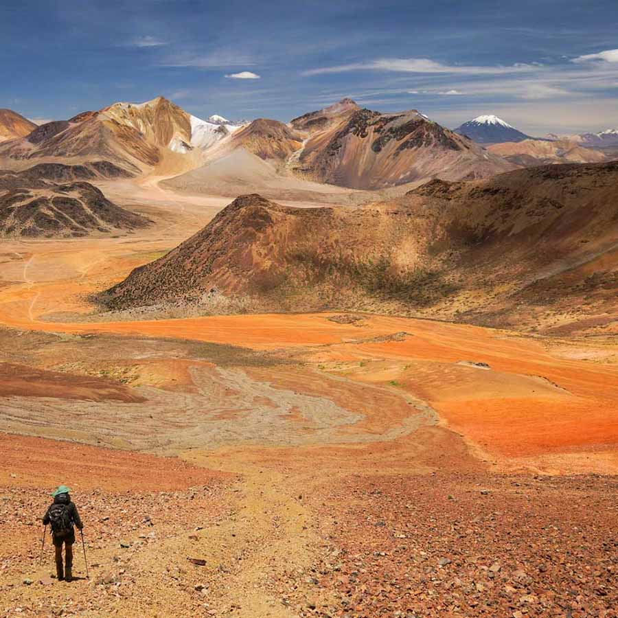
Shortly after Chusmiza, the vegetation changes again abruptly: we reach the Altiplano! We leave the narrow gorges of the Atacama Desert behind us and direct our gaze to the partly snow-covered peaks of the numerous volcanoes. The endless expanses of the Andean highlands impress with the extreme contrasts and a surprisingly lush fauna for the barrenness of the landscape: we see wild vicuñas and their domesticated relatives, the alpacas. We finally reach the start of today’s hike on the Río Aroma and follow its course upstream, where we set up camp for the night at almost 4,000m.

(B,L,D)
Overnight:Camp
Walking Time: 2 – 3 hours 
Altitude Difference: 200m

DAY 6: Rio Aroma – Cañadon

We continue to follow the valley of the Río Aroma, whose colorful rock faces narrow more and more into a gorge. We admire the rock formations under the watchful eyes of the myriad Vizcachas that inhabit the stony slopes of the river valleys. Since the river usually has little water, we reach today’s camp in the middle of the gorge with dry feet.

(B,L,D)
Overnight: Camp
Walking Time: 4 – 5 hours
Altitude Difference: 170m
Sleeping Altitude: 4000m

DAY 7: Cañadon – Churuyo

We continue to follow the course of the river and finally arrive at a highland area populated by flamingos.
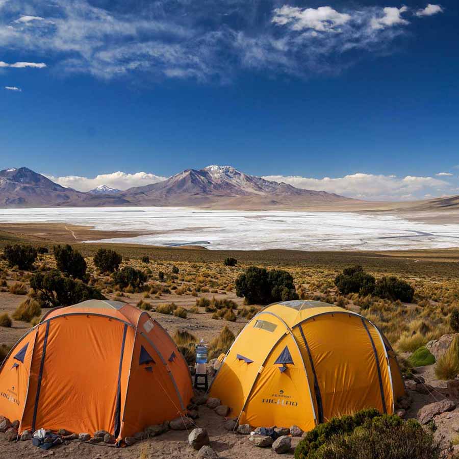
Lagoon, on the banks of which we pitch our tents for two nights. In a way the first High camp of our acclimatization at 4,300m. The stunning surroundings invite you in the afternoon Feel free to explore on your own and make up for the jump with the sunset onset of cold.

(B,L,D)
Overnight: Camp
Walking Time: 4 – 5 hours
Altitude Difference: 300m
Sleeping Altitude: 4300m

DAY 8: Churuyo – Paso Toroni – Churuyo

Today we climb to 5,000m for the first time. Directly from the camp we hike steadily towards of the towering Cerro Sillajhuay, which towers over the steppe at almost 6,000m. Our the path initially leads over idyllic high moors (so-called Bofedales), the most important water reservoirs of the dry highlands. These serve the local population as grazing grounds for their alpaca herds.
We ascend through a sparse forest of endangered Queñoa trees and giant Yareta mosses. After exhausting hours and about 700 meters of altitude difference, we finally reach the Pass road of the “Alto Toroni”, one of the highest passable passes in South America. Expected there our driver and takes us back to our camp.

(B,L,D)
Overnight: Camp
Walking Time: 5 – 6 hours
Altitude Difference: 700m
Sleeping Altitude: 4300m

DAY 9: Churuyo – BC Isluga

With a heavy heart we leave our beautifully situated lagoon camp and set off heading north into Isluga National Park. We drive through the border town of Colchane along picturesque upland moors and lagoons and make a short stopover in the small highland village of Isluga, where we admire one of the oldest churches in the entire region.
Finally we reach a small cul-de-sac that takes us to the start of the hike to the base camp of the Isluga volcano. Here we spend two nights.

(B,L,D)
Overnight: Camp
Sleeping Altitude:4400m

DAY 10: BC Isluga – Crater Isluga – BC Isluga

We continue our acclimatization. Today’s destination is the crater of the active volcano Isluga at 5,300m. The fumarole is visible from afar and offers a real one on active days natural spectacle. The view from the crater rim into the crater with its characteristic bright yellow Sulfur Fields is spectacular. We enjoy the view over the surrounding highlands and climb on the same route back to our base camp.

(B,L,D)
Overnight: Camp
Walking Time: 7 – 8 hours
Altitude Difference: 900m
Sleeping Altitude: 4600m

DAY 11: BC Isluga – Salar de Surire

A beautiful panoramic ride through a very little visited part of the Chilean Altiplano takes us north from Isluga National Park to the Salar de Surire, a surreally radiant white salt lake at 4,250m. The area is a protected natural monument belonging to a variety unique habitat for animals, most notably the huge breeding colonies of flamingos stand out But also the eponymous Darwin rheas (suris) and vicuñas are among them regularly sighted species. We will stop for lunch at the natural thermal baths of Polloquere, whose unreal turquoise-milky water stands in stark contrast to the surrounding volcanic peaks.
We set up our camp for the next two nights at the foot of Cerro Chiguana (Cerro Rojo) at 4,700m, with a unique view over the salt lake.

(B,L,D)
Overnight: Camp
Sleeping Altitude: 4500m

DAY 12: Salar de Surire – Cerro Rojo – Salar de Surire

On the program today is the ascent of the 5,330m high Cerro Chiguana (Cerro Rojo), a beautiful acclimatization peaks. The path leads past Yareta Andean mosses, Queñoa forests and small sulphurous fumaroles, evidence of volcanic activity. The mountain rises right on the edge of the salt lake and gives us fantastic views over the entire walking distance.
From the summit, on a clear day, we can see the snow-capped peaks of the six-thousander Acotango, See Guallatire, Parinacota, Pomerape and even Sajama, Bolivia’s highest peak. The descent takes place in a direct line over loose scree. A feature shared by many of the mountains in this area and that ensures that the descents are always much more effortless than the ascents.

(B,L,D)
Overnight: Camp
Walking Time: 6 – 7 hours
Altitude Difference: 850m
Sleeping Altitude: 4500m

DAY 13: Salar de Surire – BC Guallatire

We continue north, always along the east shore of the salt lake, until we reach the small village reach Guallatire, which lies at the foot of the mountain of the same name and offers us a splendid view our summit destination, the active Guallatire volcano. We take a small gravel road and approach us as far as possible the entrance to the mountain. We set up our base camp at 4,800m, go our equipment carefully and go to bed early this morning because there is a long wait summit day upon us.

(B,L,D)
Overnight: Camp
Sleeping Altitude: 4600m

DAY 14: BC Guallatire – Guallatire Climb – BC Guallatire

Our alarm clock rings in the early hours of the morning. We take a little refreshment and still in the dark we set off with our vehicle to the entrance at approx. 5,200m.
The first part leads through loose scree, later over snow fields and depending on the season also through penitential ice, which can make our progress even more difficult. At the latest by sunrise However, we are not only by the first rays of the sun, but by the stunning Panorama with views of the twin volcanoes Parinacota and Pomerape warmed so the last Altitude meters up to the summit at 6,097m can be tackled. We return to the ascent route back to the base camp and spend another night in the camp.

(B,L,D)
Overnight: Camp
Walking Time: 9 – 10 hours
Altitude Difference: 900m
Sleeping Altitude: 4600m

DAY 15: BC Guallatire – Arica

On our last day of travel we drive from 4,800m to the sea. An unreal journey involving all of us vegetation zones again in fast forward review. We’ll do one on the way short stopover at the Copaquilla Fortress and can be next to a world marvel at geoglyphs in the unique population of the Candelabrus giant cacti. We achieve finally the fertile oasis valleys of Lluta or Azapa and finally reach the sultry coastal city of Arica, Chile’s northernmost city on the border with Peru. Here we get ours Hotel, can visit the harbor and fish market and end the trip with one last dinner together.

(B,L,D)
Overnight: Hotel ****
Sleeping Altitude: 0m

DAY 16: Arica-Out

Departure is from Arica Airport via Santiago de Chile International Airport.

(B)


difficulty level

Physical requirement

Technical level

Easy

Medium

X

Hard

X

Expert

expedition season

Jan

Feb
Mar
X

Apr

X
May
X
Jun
X
Jul
X

Aug

X
Sep
X
Oct
Nov

Dec

What IS includeD?

Mountain guide

Experienced and multilingual mountain guide (Spanish, English, German)

Hotel

3 – 4* Hotels.

Security

Safety and emergency equipment: radio equipment, satellite phone, oxygen, emergency medicine, all permits for the expedition.

Transfers

Private vehicles (Toyota Hilux 4×4 or similar) throughout the Expedition.

Food

1 cook throughout the expedition.

not included

Not included

  • National and international flights.
  • Personal travel insurance.
  • Any additional costs incurred for program changes due to exceptional circumstances (eg extreme weather, natural disasters, strikes, etc.).
  • Any additional costs incurred due to the participant’s request.
  • Program changes.
  • Porters.
  • Drinks in hotels/restaurants.
  • Personal excess baggage charges.
  • Any additional costs incurred due to the participant’s request program changes.
  • Individual supplement in hotels/pensions.
  • Individual occupancy in double tents.
  • Tips.
  • Personal Equipment (See recommended equipment).
  • Any other service not included in the program.

other expeditions that may interest you

17 Days

Altitude: 6893 m.a.s.l

Physical level: Hard

Technical level: Easy

20 Days

Physical level: Hard

Technical level: Medium

16 Days

Altitude: Over 3000 m.a.s.l

Physical level: Medium

Technical level: Easy

14 Days

Physical level: Medium

Technical level: Easy

"Our travel destination is never a place, but a new way of seeing things."

Henry Miller.